Before any construction or excavation begins, having a clear understanding of what lies beneath the surface is crucial. This is where mud maps become an essential part of safe and efficient site preparation. Many builders and project managers in Sydney still ask what a mud map is, how it’s created, and why it plays such an important role in reducing the risk of underground asset strikes.
A mud map is a simplified, visual representation of underground utilities that helps teams work safely on-site. When paired with professional underground utility services in Sydney, it becomes a reliable planning tool for excavation, trenching, drilling, and construction works.
What Is a Mud Map?
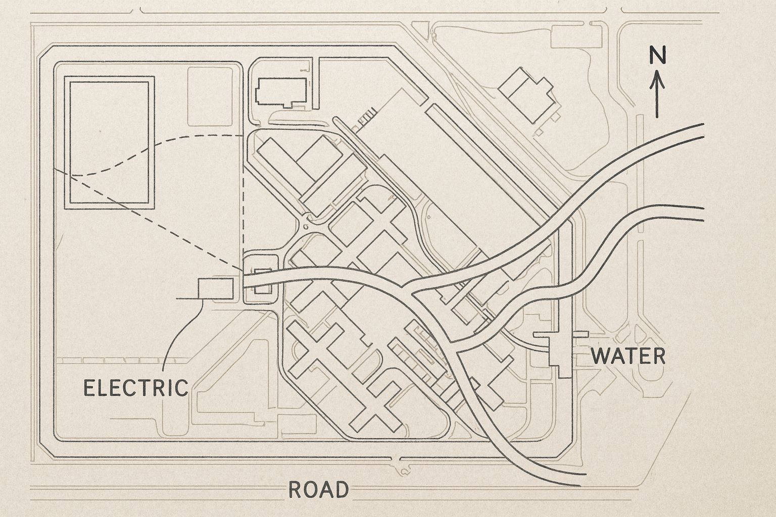
A mud map is a hand-drawn or digitally generated sketch showing the location of underground utilities such as water lines, sewer pipes, stormwater systems, electrical cables, NBN fibre, gas mains, and other buried services. While traditionally mud maps were rough sketches made on-site, modern mud mapping services in Sydney use advanced locating technologies to create precise, reliable drawings.
The purpose of the mud map is to give workers a clear, simplified overview of underground assets before digging. Unlike formal surveying or engineered plans, a mud map is easy to read, visually intuitive, and tailored to the task at hand.
Why Mud Maps Are Essential for Construction Projects
Creating an accurate mud map is one of the most important steps before breaking ground. Here’s why it matters:
Improves On-Site Safety
Understanding where underground utilities are located minimises the risk of striking active services. With Sydney’s dense network of pipes and cables, a mud map acts as a safety guide for excavation teams and contractors.
Prevents Costly Damage
Hitting underground assets can lead to:
- Gas leaks
- Water damage
- Power disruptions
- Costly repairs
- Council fines
A detailed mud map ensures excavation follows safe pathways and avoids high-risk zones.
Enhances Construction Efficiency
With the right information in hand, contractors can plan more efficiently. Teams waste less time guessing utility positions, leading to smoother workflow, fewer delays, and reduced downtime.
Ensures Compliance With Sydney Regulations
Builders and contractors must meet safety compliance standards before starting excavation. Mud maps created by professional underground utility services in Sydney help you meet those requirements with confidence.
Supports Long-Term Site Planning
Accurate utility information prevents future issues and allows for better decision-making on layout, trenching, and service installation.
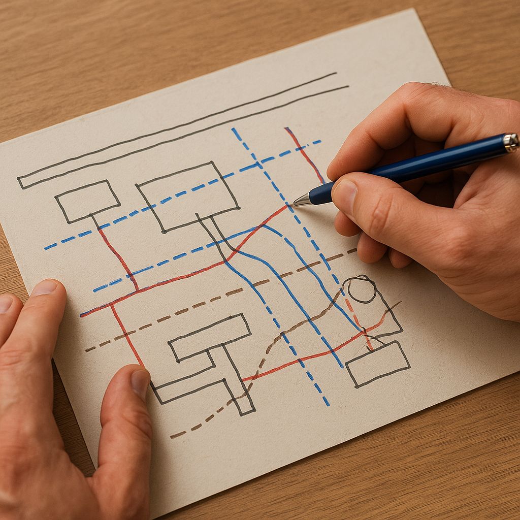
How to Create Accurate Mud Maps
Developing a reliable mud map requires more than a pencil and a clipboard. Today’s locating professionals use advanced technology to deliver precise and detailed mapping.
Step 1: Gather All Available Utility Information
Start by reviewing Dial Before You Dig (DBYD) plans, council records, and existing property documents. While these are helpful, they are not always accurate or up-to-date.
Step 2: Conduct a Full Utility Scan
Professional locators use multiple technologies to identify buried services, including:
- Ground Penetrating Radar (GPR)
- Electromagnetic Field (EMF) locating
- CCTV drain inspections
- Acoustic pipe tracing
These tools provide accurate data on depth, material type, and asset location.
Step 3: Record Utility Positions on the Map
Each utility is sketched or digitally mapped with clear lines, depth indications, direction of flow, and identifiable markers. This ensures the mud map becomes a functional reference for the construction team.
Step 4: Annotate the Map with Key Site Details
Information may include:
- Distances from permanent landmarks
- Service depth ranges
- Safety buffer zones
- Entry and exit points for machinery
These details help workers navigate underground conditions safely.
Step 5: Review and Verify for Accuracy
A professional locator will cross-check scan data, confirm utilities, and ensure the mud map reflects real-world conditions before excavation begins.